 |
DOWNSTREAM GUIDE
|
It was a way for people in the neighborhood
to give days of their labor to one another,
to give one another shares in their mutual place…
–Wendell Berry about the River Walk |
|
 |
How to Use this Guide
|
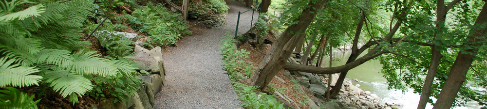
| River Walk follows the west bank of the Housatonic River between Cottage Street and Bridge Street. The trail’s two sections are linked by Dresser Avenue and River Street. The upstream section extends from the River Walk bulletin board at 195 Main Street to the William Stanley Overlook. The trail exits at the stairs to St. Peter’s Church parking lot on Dresser Avenue. The downstream section of the trail begins adjacent to the Berkshire Corporation parking lot on River Street and ends at Bridge Street.
Thirteen points of interest are shown on the River Walk maps—the Upstream Map shows sites A through F, and the Downstream Map shows sites G through M.
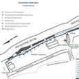
CLICK to download the full 50-page guide. Or read highlights below.
Click Map for High Resolution PDF
|
|
 |
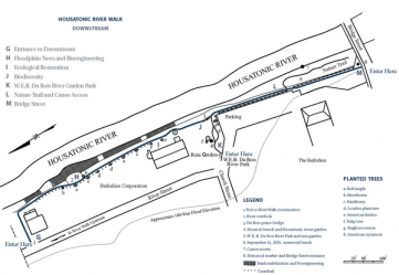
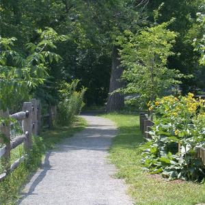
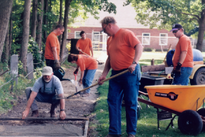
G Entrance to Downstream
|
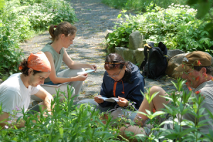
| This is the north entrance to River Walk’s downstream section, begun in 1997. It contains two places of historical significance. One site is dedicated to civil rights pioneer and Great Barrington native W.E.B. Du Bois, and the other commemorates an important conflict between Native Americans and European settlers. The downstream section is for walking and nature viewing and is accessible.
|
|
 |
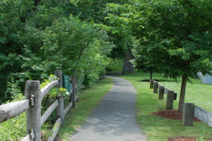
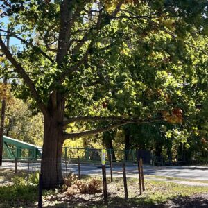
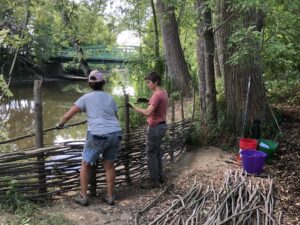
H Floodplain Trees and Bioengineering
|
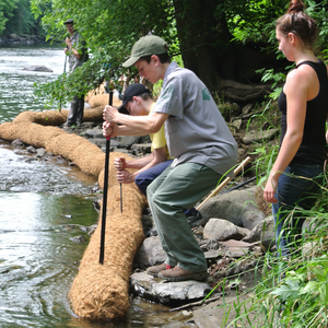
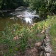
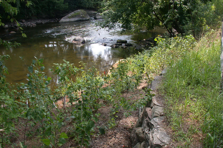
| Native floodplain trees have been planted along the path to provide cooling cover that is essential for a healthy river. The areas on either side of the splitrail fence are managed very differently. On the river side, where steep banks meet the water’s edge, we weed invasive exotics and plant native species to encourage native habitat. On the path side, cultivated public gardens of native plants and a row of specimen trees follow the trail. The overlook is a good spot for watching the river and wildlife. Volunteers have spotted beaver, muskrats, skunks, raccoons, deer, great blue herons, cedar waxwings, chickadees, eagles, osprey and kingfishers. River Walk’s downstream section is built on filled floodplain that erodes easily. Biologs pinned to the riverbank deflect the erosive power of the river and collect silt. Combined with native vegetation, they combat the worst ravages of storm events and flooding.
|
|
 |
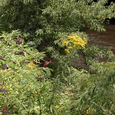
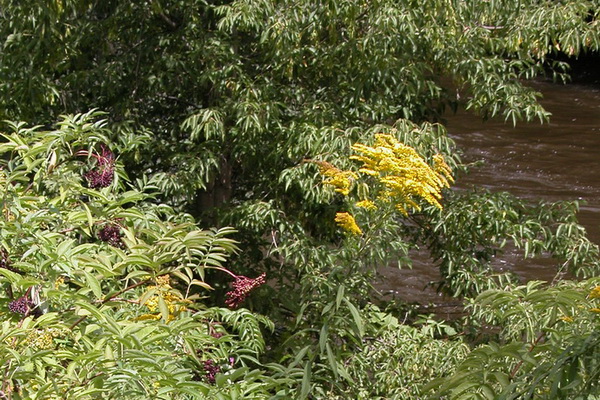
I Ecological Restoration
|
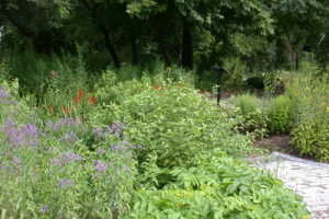
| River Walk’s downstream area was covered in Japanese knotweed, an aggressive and invasive polygonum that crowds out all other plant life. Volunteers keep the knotweed at bay through regular cutting of recurrent stems, without use of herbicides, and with dense plantings of native plants, shrubs and trees. The riverbank here is steep and unstable, eroded by the action of a constrained river into almost vertical walls. Bioengineering is the technique of using living organisms to achieve structural ends. In 2008, combined engineered and vegetative techniques stabilized a severely battered segment of riverbank. Cuttings of existing stoloniferous plants such as willows and shrubby dogwoods protect the upper bank. Over twenty new species of riparian plants, including swamp white oak, pin oak, elderberry, witch-hazel, alder, dogwood and viburnum, enhance biodiversity.
|
|
 |
J Biodiversity
|
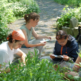
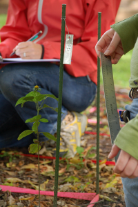
| For a time, aerobically brewed compost tea was used on various areas of the River Walk to improve and diversify soil life. The non-toxic tea is a coldwater extract of compost. It is tested to assess the quality and quantity of its microorganisms, then applied to the soil to assist plant growth. In 2006, biologist Suzanne Fowle and environmental scientist Dr. Don Roeder directed a study to monitor the growth and success of four species of native plants: woodland sunflower (Helianthus decapetalus); agrimony (Agrimonia gryposepala); spicebush (Lindera benzoin); and maple-leaved viburnum (Viburnum acerifolium). Our results helped prioritize future plantings and directed the compost tea applications. Over the years our efforts to increase biodiversity have focused on pollinator species and butterflies. Monarch butterflies in particular.
|
|
|
K W.E.B. Du Bois River Park
|
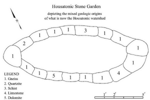
| The W.E.B. Du Bois River Park, dedicated in 2002 to this pioneer of the civil rights movement and his love of rivers, includes a rain garden and a raised garden made of stones — gneiss, quartzite, schist, limestone and dolomite — that represent the mixed geologic origins of the upper Housatonic watershed. The plants that grow here are the first yield of our Native Natives whose genetic provenance is here in western Massachusetts. The stone bench was dedicated in 2006 to the memory of River Walk’s horticulturalist Monica Fadding. The permanent outdoor exhibit W.E.B. Du Bois: Champion of Rivers opened to the public in 2012.
Click Map for High Resolution PDF
|
|
 |
L Riverbank Nature Trail
|
| This property was once the site of Searles High School, which opened in 1898 and closed in 1989, and was then converted into Searles Middle School. In 1989 seventy Searles eighth-grade students cleaned up the riverbank next to their school, hauling out twenty tons of trash and wood waste to create a nature trail. The surrounding area was once a floodplain capturing nutrient rich sediment carried by the river. Layers of vegetation and permeable soils sustained the purity of the water quality. Wetlands hosted diverse communities of animal and plant life. River Walk combats the ill effects of development with permeable trail surfaces and specially fitted storm drains that filter toxins and impurities from stormwater. In 2016, work began for the preservation of the school building and its reuse as a luxury hotel. The Berkshire Hotel is working with River Walk to reclaim the riverfront and its native habitat.
|
|
 |
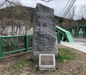
M Bridge Street Entrance
|
| Bridge Street provides the southern entrance to River Walk’s downstream section. A stone marker commemorates one of the first documented incursions by colonial forces into the Upper Housatonic Valley. During the conflict known as King Philip’s War, or Metacom’s Rebellion, Native Americans tribes united together to fight the encroachment of European settlers on their lands. In August of 1676 Major John Talcott overtook a fleeing band of the Narragansett tribe. The precise location of the massacre is disputed – some sources place it as far south as Sheffield, Massachusetts or Salisbury, Connecticut – so the monument should not be considered authoritative on this point.
|
|
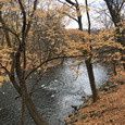 |
The Housatonic River
|
| The Housatonic River flows 150 miles from four sources in western Massachusetts and passes through the Berkshires and western Connecticut before it empties into Long Island Sound. The watershed, or land area that drains into the river, encompasses 1,948 square miles and includes hundreds of rivers and streams.
|
Excerpts by Wendell Berry reprinted with permission from U.S. Catholic magazine, Claretian Publications, www.uscatholic.org, 800-328-6515. Excerpts by W. E. B. Du Bois, 1920, Darkwater; 1930, “The Housatonic River Speech,” Berkshire Courier; 1960, to Ronald Linder, Berkshire Courier; 1961, reprinted with permission of the family of the late George P. Fitzpatrick.
|
|